
PhD student Patricia Varela, of Civil Engineering’s Stochastic Geomechanics Laboratory, kicked off GEOSAT’s fall seminar series with an integrated approach to mapping the risk of landslides over a spatial domain.
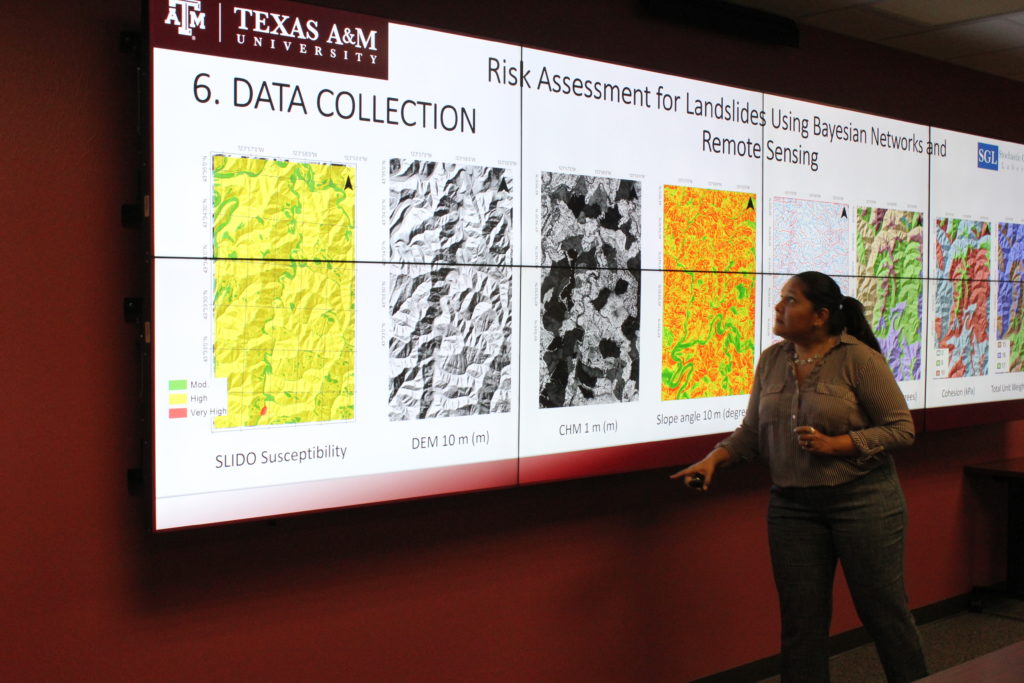
Patricia Varela and Dr. Medina-Cetina, civil engineering associate professor, used Bayesian Networks to integrate LiDAR derived products such as Canopy Height Models and Digital Terrain Models, with ancillary data into an integrated risk model. The variables used by this model consisted on an official landslide susceptibility map named SLIDO, a Factor of Safety evaluating the landslide stability, Vegetation Density and Wetness Index. This model was implemented to visually quantify different degrees of risk intensity for landslide susceptible regions within the Oregon Coast Range.
“For decision-making purposes, it [Bayesian Networks] can be really relevant,” Patricia states, “it’s a very useful tool for integrating different types of information.”
This study is not the first to apply Bayesian Networks to risk assessment of landslides susceptible regions. However, the study provides unique means of integrating Bayesian Networks into Geographical Information Systems (GIS), which can be an asset in today’s rapidly progressing GIS age. GIS has advanced to be more complex and accurate, leading to increased storages of data over a single geographical region. With this additional, higher quality data, more advanced methods are needed to interpret and analyze the region for improved understanding and decision-making.
Another unique feature highlighted in the study is Bayesian Networks ability to calibrate and test its models. By using DOGAMI’s catalogued historic landslides within the region and by comparing it to the risk maps’ assessment of landslide, Patricia and Dr. Medina-Cetina were able to validate the Bayesian Network’s risk map estimates. This tool can be used to select the locations that requires the allocation of resources for minimizing the landslide vulnerability on the existent infrastructure of a given site, which represents a more efficient and improved decision making process.
Civil Engineering masters student Miguel Ortiz Cahun found the calibration component very interesting, noting that the method used to calibrate the landslide risk maps may be applicable to other areas of study. He was interested in exploring if a similar calibration approach could be applied to his area of study.
Overall, Patricia expressed satisfaction with the presentation’s reception by the audience. Additionally, Patricia remarks that the coupling of Bayesian Networks and GIS has many additional applications and looks forward to further exploring them. An application she has already implemented relates to assessing environmental risk among oil and gas infrastructure with drilling and production activities in Texas’ Barnett Shale.
If interested in attending the remaining fall semester’s seminar presentations, see GEOSAT’s event page.
Contributing Author: Rachel Holanda