
The average individual might not consider the amount of time, funds, and effort that went into creating the geological maps hanging on their wall. A geologist went out into the field; treaded through, potentially, tough and treacherous terrain; took numerous measurements; and struggled to knit the collected data together into a 2-D representation of the region. Ph.D. student Brennan Young points out this approach towards mapping is not very efficient.
Brennan remarks, “It’s laborious and costly and invokes a significant degree of subjectivity.”
Brennan Young is a Texas A&M geography Ph.D. student advised by Dr. Michael Bishop. In contrast to the more traditional, qualitative approach, together they are improving ways of quantitatively characterizing landforms, such as valleys, plateaus, mountain peaks, by applying semantic modeling and graph theory.
In today’s technologically advanced and big data age, new means of mapping landforms and surface processes are emerging. Earth scientists now have access to a variety of GIS-based data collected via remote sensing. To process these large stores of data, geographers have further developed geomorphometry, a quantitative or mathematical approach to characterize geographical features and surface processes. Brennan highlights that this mathematical characterization of geographical features leads to improved consistency, objectivity, and cost-effectiveness throughout the mapping process.
However, these mathematical algorithms’ ability to properly capture various geographical features still lags and makes mistakes signaling that further research is needed to fill in the gap. Dr. Michael Bishop and Brennan Young hope to fill the void by developing an improved approach using semantic modeling and graph theory.
Instead of evaluating the terrain as a neighborhood of grid cells, hypsometric zones or set of fuzzy entities, graph theory provides a framework to evaluate the context and hierarchical relations between terrain entities. Semantic models combine mathematically defined parameters to identify specific topographic forms, which can be connected to other topographic forms, forming a network. The properties of these networks, such as the number of nodes (topographic forms) and the connectivity between the nodes, allow the method to consider the overall geographic structure and context when making evaluations about the overall structure of the topography.
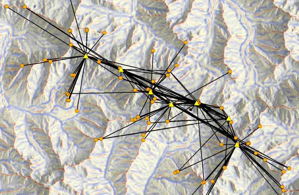
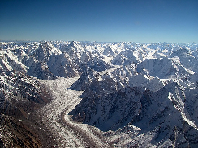
In their specific case study, Dr. Bishop and Brennan applied their approach to the Karakoram of the Himalayas, a region known for its broad array of geomorphic features and extreme relief. Using topographic data collected by Shuttle Radar Topography Mission (SRTM v3), their approach was able to identify various landforms and surface processes, such as glacial and river-formed valleys and zones of rapid tectonic uplift.
The method developed by Dr. Bishop and Brennan can serve as a valuable resource for industries such as mining, oil exploration, and recreation. By providing a more effective means of mapping, industries can focus their efforts and minimize the cost and time spent by sending a team of scientists out into the Himalayas or other remote locations. Now geologists can remain within the cozy confinements of an office creating those detailed and accurate topographic maps hanging on their office walls, or at least that is what they are looking forward to.
To find out more about GEOSAT seminar series and events, visit the events page by clicking here.
Contributing Author Rachel Holanda